Echoview 15 includes the ability to create and use multiple platforms in the Dataflow window, making it easy and convenient to compare data collected from different vessels (or other types of data collection platforms) that are in different locations at the same time. Each platform can be configured to use independent sources of GPS, heave/depth compensation, heading, and more.
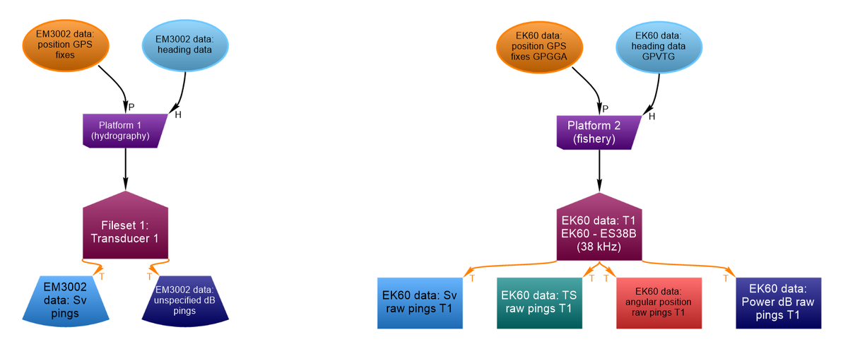
EV files support multiple platforms, making it possible to compare data collected from different vessels at the same time. In this case, a hydrographic survey vessel was concurrently collecting data at the same time as a fishery survey vessel. Both platforms can now be loaded into the same EV file for data review and processing.
We’re also introducing the ability to customize the appearance of cruise tracks. New settings are available in the EV File Properties dialog box that allow you to choose:
- Thickness for the lines representing:
- cruise track path
- latitude/longitude (or easting/northing) grid lines - Colors for:
- map cursor
- good and uncertain portions of the track
- good and bad fixes
- latitude/longitude (or easting/northing) grid lines
The cruise track color and thickness settings are also used when cruise tracks are included in 3D scenes.
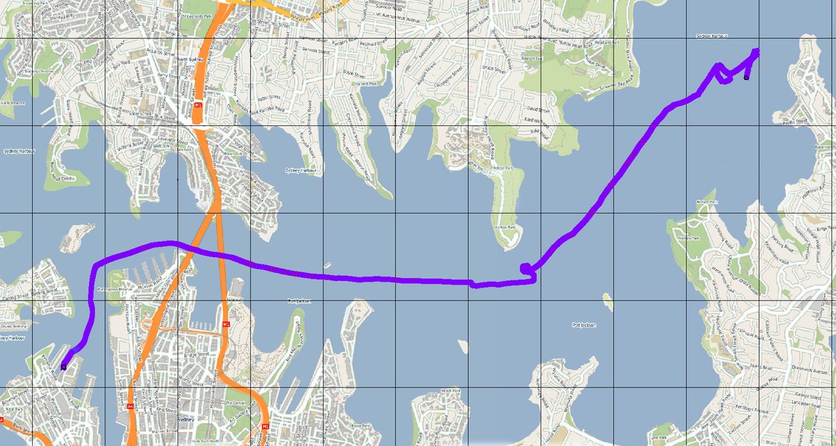
Data recorded in Sydney Harbour, where the cruise track is set to display using an increased thickness and a purple color, making it easier to see when overlaid on an OpenStreetMap WMS background map.
Echoview 15 will be available for beta testing soon, and will be officially released in the second half of 2024.
Did you see our previous sneak peeks?
To be notified when new releases are available, please join our mailing list.